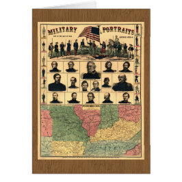
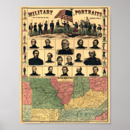
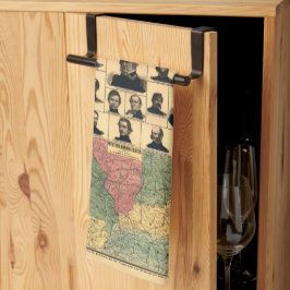
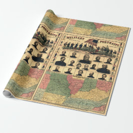
Civil War Border Military Portraits 1861, Restored
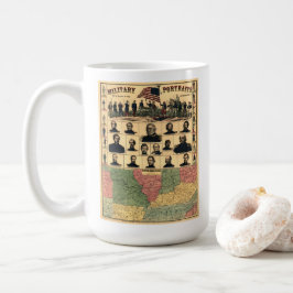
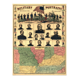
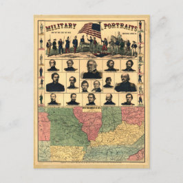
Title: Military portraits, map of the seat of war, uniforms, arms, &c. Published: 1861 LC Civil War Maps (2nd ed.) N.Y., New York H. H. Lloyd & Co. Map of western border states -- Missouri, Tennessee, and parts of Nebraska, Kansas, Indian Territory, Arkansas, Illinois, Indiana, Ohio, Kentucky, Virginia, North Carolina, and South Carolina, showing cities and towns, rivers, and railroads. Important sites marked in red. Portraits of Generals Wool, Dix, Scott, Fremont, Lyon, McClellan, Banks, Blenker, Butler, McDowell, Rosecrans (Rosencranz), Sprague, Burnside, and Sigel, Colonel Corcoran, and Commodore Stringham. Digitally restored by VintageSketch to reduce creases and smudges; colors enhanced.
7 resultat
Civil Krig Gräns Militär Porträtt 1861, återställd Hälsningskort
Försäljningspris 51,00 kr. Ursprungligt pris 56,00 kr.
Andra kollektioner ni kanske gillar av VintageSketch
Nyligen besökta produkter